Smart Airports

The Evolution of Common Use in Airports: From LAX to Shanghai and Beyond

The Evolution of Common Use in Airports: From LAX to Shanghai and Beyond

The Rise of Common Use and What It Means for Airlines and Passengers

Abstract

The common use approach in airports has become an increasingly popular trend in the aviation industry, driven by the need for cost savings, increased efficiency, and improved passenger experience. By sharing infrastructure, technology solutions, and terminal facilities, airlines can reduce costs, improve turnaround times, and adapt more easily to capacity constraints. Digital platforms, self-service kiosks, automated baggage handling, and gate assignment management systems are just a few examples of the technology solutions that are enabling shared infrastructure in airports. Additionally, common use infrastructure provides increased flexibility and environmental sustainability, making it an attractive option for airports and airlines alike. This article explores the key benefits of common use in airports, and how the industry is leveraging technology and collaboration to drive innovation and efficiency in airport operations.

History of Common Areas

The concept of common use in airports has been around for several decades, but it has evolved significantly over time as technology and the aviation industry have changed.

The first airport to implement a common use system was Los Angeles International Airport (LAX) in the 1960s. At the time, LAX was experiencing significant growth in air traffic and did not have enough space to accommodate all the airlines that wanted to operate there. To address this issue, LAX implemented a common use system that allowed airlines to share terminal facilities and infrastructure.

Over time, the concept of common use spread to other airports around the world, driven in part by the growing need for cost savings and efficiency in the aviation industry. In the 1980s and 1990s, airports began to develop more sophisticated common use systems, using technology such as computerized reservation and check-in systems to facilitate shared use of infrastructure.

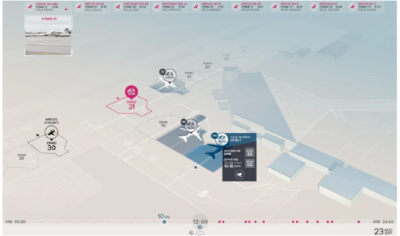
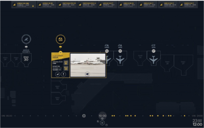
In the 2000s and 2010s, the trend towards common use continued to accelerate, with airports investing in advanced technologies such as self-service kiosks, automated baggage handling systems, and digital platforms to manage gate assignments and baggage handling. These technologies have made it easier for airports to facilitate common use while also improving efficiency and the passenger experience.

What are the main benefits to this approach?

There are several benefits to the common use approach in airports:

  1. Cost Savings: Common use infrastructure allows multiple airlines to share the same facilities and equipment, reducing the need for each airline to invest in its own infrastructure. This can result in significant cost savings for airlines, which can be passed on to passengers in the form of lower ticket prices.
  2. Improved Efficiency: By sharing infrastructure, airlines can improve efficiency and reduce turnaround times for aircraft. This means that planes can spend less time on the ground and more time in the air, resulting in increased revenue for airlines and fewer delays for passengers.
  3. Increased Flexibility: Common use infrastructure allows airlines to adapt more easily to changing demand and capacity constraints. For example, if an airline experiences a sudden increase in demand, it can use common use facilities to quickly add more flights and capacity.
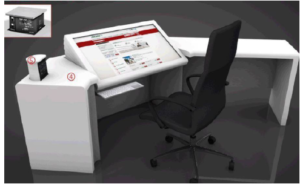
  4. Enhanced Passenger Experience: Common use infrastructure can also improve the passenger experience by providing access to more amenities and services, such as lounges, self-service kiosks, and automated baggage handling systems. This can help reduce wait times and make the travel experience more convenient and enjoyable for passengers.
  5. Environmental Benefits: By reducing the need for each airline to invest in its own infrastructure, common use infrastructure can also help reduce the environmental impact of air travel. For example, shared baggage handling systems can reduce the amount of energy and resources needed to process baggage, while shared lounges and amenities can reduce the amount of space needed for each airline to provide its own facilities.

In Conclusion

Overall, the common use approach in airports offers numerous benefits to airlines, passengers, and the environment, making it an increasingly popular trend in the aviation industry.

In conclusion, the common use approach in airports has become an increasingly important trend in the aviation industry, driven by the need for cost savings, increased efficiency, and better service for passengers. By sharing infrastructure and technology, airlines and airports can reduce costs, improve turnaround times, and enhance the passenger experience. Additionally, common use infrastructure can provide increased flexibility and environmental benefits, making it a win-win solution for all parties involved. As the industry continues to evolve, it is likely that common use will become an even more important trend, helping airlines and airports stay competitive and meet the changing needs of passengers and the environment.

The Evolution of Common Use in Airports: From LAX to Shanghai and Beyond2023-04-14T09:36:18-07:00

Rise of the Smartivist: A New Paradigm for the Smart City

Rise of the Smartivist: A New Paradigm for the Smart City?

Summary:

The concept of smart cities has evolved over the past seven years, moving from a technology-centric vision to a more human-centric approach. The latest stage of this evolution is being referred to as “Smart City 3.0,” where the emphasis is on collaboration and participation with citizens to create solutions that improve quality of life and generate prosperity. The key to success in this new paradigm is collective intelligence and a user-centric approach that takes into account the needs of all stakeholders.

Concept of Smart Cities:

The concept of smart cities has been evolving rapidly over the past seven years, and the way cities approach urban transformation has changed dramatically. Initially driven by technology providers, governments have now realized that technology is just an enabler for achieving their goals and that top-down approaches or a “master planned” vision are not the key to success.

There have been three generations of smart cities so far:

  1. Smart Cities 1.0: a technology-driven vision led by major technology companies to create efficient and innovative cities.
  2. Smart Cities 2.0: a government-led vision that utilizes technology as an enabler to improve quality of life.
  3. Smart Cities 3.0: a citizen- or human-centric vision of smart cities that is based on co-creation with citizens to improve quality of life and generate prosperity.

According to Boyd Cohen’s framework of evolutionary smart city stages, cities around the world are following different strategic approaches based on their development and knowledge status. Some cities begin with a technology-centric approach, while others start with government-led initiatives that embrace technology. However, neither of these approaches is sufficient for creating a better, more livable, and sustainable place for all stakeholders.

The key to creating a smart city 3.0 is to facilitate participation and collaboration across all stakeholders. It’s important to know why smart city solutions are needed, how they can be implemented, what benefits they offer, and whether any risks or objections exist. This requires a bottom-up, co-creation approach that takes into account the needs and problems of citizens, businesses, commuters, entrepreneurs, academia, and non-profit organizations.

The definition of a “smart city” has evolved to include not just technology but also a user-centric approach that takes into account the needs of all actors. The acceptance and use of smart city solutions require a participative, open, transparent, and inclusive mindset. Collective intelligence is the key to success, representing a new paradigm in the development of smarter cities.

In conclusion, the journey towards becoming a smart city is not primarily driven by a technology partnership or a government-led master plan. It’s the result of intelligent initiatives and solutions that are created and adopted through collective intelligence, enabling an efficient transformation of the community. The new paradigm of smart cities requires the rise of “smartivists” who understand the importance of participation and collaboration in creating a better place for all.

Rise of the Smartivist: A New Paradigm for the Smart City

January 14th, 2023|Comments Off on Rise of the Smartivist: A New Paradigm for the Smart City

Rise of the Smartivist: A New Paradigm for the Smart City? Summary: The concept of smart cities has evolved over the past seven years, moving from a technology-centric vision to a more human-centric [...]

What is a Digital Twin?

June 21st, 2019|0 Comments

What is a Digital Twin? ADVANCED IMAGING ALGORITHM FOR THE DIGITAL MANAGEMENT OF BUILDINGS AND CONSTRUCTION SITES What if we could have instant access to all the information about a construction site, down [...]

Rise of the Smartivist: A New Paradigm for the Smart City2023-02-11T12:46:24-08:00

Case Study – Smart Airport Italy

Case Study – Smart Airport Italy

Airport Logistics Facility Management

Alitalia was in desperate need of reducing costs and personnel Image result for official ibm partner logoredundancy around their shipping and logistic facilities when partnering with Etihad investing as a main stakeholder in the company.

Sub-contracted by IBM, our main partners when developing server networks and system nodes, we had the task of engineering and realizing the project.  According to the technical inspection and to the information received, the infrastructure was composed by 28 different systems, separately managed.

Ground Star System for the parking areas occupation scheduling of aircrafts and ground means for logistics.
ADM (Airport Data Management)showing the data coming from Enav Radars and used at the same time for sending information to inbound aircrafts.
Avigilon stream system used for the verification of the parking areas occupational state.
SDK Avigilon application, developed for showing  every single parking position: arrival and departure data inclusive of video stream.
Motorola Tetra System for radio communication via the airport and the Major Handler.

Final Project Build

The following external services have been taken into consideration for further verification of the
flight status : Flightradar24 – Eurocontrol –

The Help System, integrated in the platform manages the following activities;  GPS VehiclesTracking – Events – Tele warning
ADM data coming from ENAV radars

The interface proposes a first overview with the visualization of the status of every system in field and  list of inbound flights.
Automatically the system warns the operator that is necessary to confirm to the control tower the automatically assigned stand.
The operator clicks on the alerted stand and so he sees its actual state (free/occupied) through cameras automatically streaming on location.
When the operator touches the alerted stand, a panel proposes the video stream of the selected stand as well as other information on the flight, as arrival and departure data, departure gate, check-in desk and baggage-handling conveyors.
Clicking on the button on the same panel, the operator can confirm it with a simple touch on the screen and send the data to the control tower.

A time-bar will allow the operator to examine the history of the past 24 hours and the scheduling of the following 4 hours.
Additionally, from the Managing Monitor it will be possible to use the Radio Communication System. The operator will in fact dispose of a panel that will allow him to communicate via chat and / or voice with the operators in the field
Additionally, it will be possible to integrate weather information services and visualize their data on the visualized terminal area.

Rise of the Smartivist: A New Paradigm for the Smart City

January 14th, 2023|Comments Off on Rise of the Smartivist: A New Paradigm for the Smart City

Rise of the Smartivist: A New Paradigm for the Smart City? Summary: The concept of smart cities has evolved over the past seven years, moving from a technology-centric vision to a more human-centric [...]

What is a Digital Twin?

June 21st, 2019|0 Comments

What is a Digital Twin? ADVANCED IMAGING ALGORITHM FOR THE DIGITAL MANAGEMENT OF BUILDINGS AND CONSTRUCTION SITES What if we could have instant access to all the information about a construction site, down [...]

Case Study – Smart Airport Italy2021-10-15T12:14:22-07:00

What is a Digital Twin?

What is a Digital Twin?

ADVANCED IMAGING ALGORITHM FOR THE DIGITAL MANAGEMENT OF BUILDINGS AND CONSTRUCTION SITES

What if we could have instant access to all the information about a construction site, down to smallest details about every person, tool, and bolt?

What if we could always be sure about the final measurements of a beam or that soil volumes in the cuts are close to those of the fills? What if we could always track how fast the supply of materials runs out, and re-order supplies automatically?

Konectcity Platform is essentially a link between a real world object and its digital representation that is continuously using data from the sensors. All data comes from sensors located on a physical object ( HVAC, thermostats, alarms, cameras, database; this data is used to establish the representation of an existing object in our VR world so that, from one single screen, we interact with the 3d virtualization of every connected asset wherever located in the globe.

Using KonectCity means always having access to as-built and as-designed models, which are constantly synced in real-time

Predictive analysis based on algorithm and machine learning

We can use the model predictive control approach and make decisions based on forward simulation, beginning with the current state of the building. So we can always analyze different paths of actions and estimate their probabilities and corresponding cost functions in order to select the most optimal decision (or adjustment) for what we should do next.

Our AI automated progress monitoring verifies that the completed work is consistent with plans and specifications. A physical site observation is needed in order to verify the reported percentage of work done and determine the stage of the project.

By reconstructing an as-built state of a building or structure we can compare it with an as-planned execution in BIM and take corresponding actions to correct any deviations. This is usually done by reconstructing geometry of a building and registering it to the model coordinate systems, which is later compared to an as-planned model on a shape and object level.

Often data for progress monitoring is collected through the field personnel and can be hugely subjective. For example, the reported percentage of work done can be faster in the beginning and much slower close to the end of the project.

People tend to be initially more optimistic about their progress and the time needed to finish the job.

Hence, having automated means of data collection and comparison means that the resulting model to as-designed  BIM models is less liable to human error. Digital twins solve the common construction process problems helping saving time, overrunning costs and resources greatly benefiting the bottom line.

AS BUILT VS AS DESIGNED MODELS

With a real-time digital twins, it is possible to track changes in an as-built model daily and hourly. Early detection of any discrepancies can lead to a detailed analysis of historical modeling data, which adds an additional layer of information for any further decision making processes.

Project managers can track and reconstruct steps that led to errors adjusting work schedules accordingly in order to prevent any similar mistakes from occurring.

They can also detect under-performers and fix the cause of the problem planning the necessary changes to the budget and timescale of the whole project. According to the Construction Industry Institute, about 25% of productive time is wasted on unnecessary movement and handling of materials. Our technology provides automatic resource allocation monitoring and waste tracking, allowing for a predictive and lean approach to resource management. Companies would avoid over-allocation dynamically predicting resource requirements on construction sites, thus avoiding the need to move resources over long distances greatly improving time management.

The construction industry is one of the most dangerous sectors in the world.

Early notification, using our advanced AI combined with video cameras and mobile devices combines an extensive safety net letting construction managers know when a field worker is located in dangerous proximity to working equipment and sending a notification about nearby danger to a worker’s wearable device.

The real-time site virtual reconstruction allows companies to track people and hazardous places so as to prevent inappropriate behavior, usage of unsafe materials, and activities in hazardous zones.

Optimization

Equipment utilization is an important metric that construction firms always want to maximize. Unused machines should be released earlier to the pool so others can use them on other sites where they are needed. With advanced imaging and automatic tracking, it is possible to know how many times each piece of machinery has been used, at what part of the construction site, and on what type of the job.

Some countries impose tough regulations on how to monitor people presence on a construction site. This includes having a digital record of all personnel and their location within the site, so that this information could be used by rescue teams in case of emergency. This monitoring is another digital plug in offered by our platform.

Data processing and analytics

UAV are habitually used to collect laser dots referral points combining imaging cameras and sensors to build augmented reality images. A high rate of generated data demands an even higher rate of data processing and fully-automated pipelines, from data capturing and analysis to knowledge and decisions. Our geospatial engine processes high volumes of data for all layers and connected assets always offering real time information with a precise location and positioning on map offering a VR visualization on screen. Our system combines the most advanced photogrammetry algorithms combined with Structure from motion acquisition ( drones and cameras ) . These elements combined offer denser 3D representations that are more accurate in measurements when compared to any other method.

LOCALIZATION

Simultaneous localization and mapping (SLAM) constitutes the computational problem of constructing or updating a map of an unknown environment, while simultaneously keeping track of an agent’s location within it.

Object detection and recognition is a cornerstone for robotic applications on construction sites, as robots need to know the location of obstacles for navigation and path planning. It is also an important thing for robots’ manipulators: they need the precise location of the objects to be picked up or moved.

In our VR modelling construction companies can use object detection and recognition to create better models of hazardous spaces and to monitor complex machinery on-site. It usually involves a combination of sensors, such as a camera, radar, LIDAR, and inertial measurement unit (IMU), if an agent is moving. The agent can be a robot, a crane, or a head- mounted display a worker is wearing at a construction site.

Another usage of object tracking is to recognize gestures in human-computer interactions, which can be harnessed for the automatic recognition of workers’ hand signals on a construction site.

KonectCity helps to better represent the as-build project at any point in time. It allows up-to-date information to be fed back to the field so as to decrease the number of errors and reworks.

With continuous localization and tracking of people and equipment it is possible to completely monitor the use of time utilization and dynamically allocate resources in order to decrease time of waiting for free machinery or the inefficient use of expensive equipment.

Moreover, real-time monitoring can push security alerts about hazardous situations right to ta worker’s mobile phone or headset, which increases the safety of a construction site. It also offers all data about who is present on a construction site and where they are located, in case of emergency.

What is a Digital Twin?2021-10-15T11:41:49-07:00

When Communication is Resilient?

When Communication is Resilient

Dealing with air traffic and communications between pilots and control tower, our system knows all way to communicate and has learned how to automatically switch among conventional and non conventional communication protocols whatever it might occur so to ensure that proper instructions are transmitted.

In Mexico we demonstrated how fast our platform reacts saving 16,900 lives in 123 different locations in under two minutes with all phones being disconnected by the monstrous earthquake.

Communication systems are integral to how our society functions, including broad reliance on mobile devices and the internet. The resilience of communications systems is one of the most critical aspects of community resilience, as nearly all other forms of infrastructure are dependent on clear and reliable communications.

Communication systems play a critical role during and after a hazard event. People rely on landline telephones, cellular or mobile systems, internet access, and cable and broadcast television to monitor the situation and to contact family members, schools, employers, and emergency responders. In addition, government and other public agencies disseminate information to the public through one-way communication systems. Informal networks that reinforce the capacity of communities to respond to extreme events are also reliant on communication systems to mobilize and to respond.

Unfortunately, communications systems have failed in multiple ways as a result of hazard events. Physical damage to communications infrastructure and critical equipment can also lead failure of dependent energy, water, and transportation systems. And in the aftermath of hazard events, service disruptions can occur when user demand exceeds the capacity of the system.

To identify the level of communications performance and resilience a community needs, stakeholders—including service providers, critical facilities representatives, local businesses, and representatives of interdependent infrastructure systems—can form a team to explore their needs, threats, and potential mitigation strategies.

Communications time horizons

A community that has experienced a hazard has short (0–3 days), intermediate (1–12 weeks), and long-term (4–36+ months) recovery needs. Specific to communication systems, communities traditionally focus on short-term recovery needs that facilitate emergency response and management goals. These include:

Relaying emergency and safety information to the public.

Coordinating recovery plans among first responders and community leaders.

Communication between civilians and emergency responders via 9-1-1.

Communication between family members and loved ones to check on each other‘s safety.

Continued operation of informal and private networks that support community recovery.

When addressing resilience to help a community prepare for the next hazard event, longer-term communications infrastructure needs include:

The ability to communicate with employers, schools, and other aspects of individuals’ daily lives,

Re-establishing data and voice communication operations of businesses, banks, and government services to resume commerce, and

Restoring, retrofitting, and improving infrastructure components to avoid failing in the same way during future events.

Measuring communications performance

Performance in communications systems is measured by the following variables:

Availability refers to the percentage of time a communications system is accessible for use. The best communications networks achieve 99.999 percent availability—they are unavailable for only five minutes per year. Availability drives the communications industry and service providers continually invest to improve this measure of their systems.

Reliability measures the frequency of interruptions. Though a communications network may have high availability, multiple brief downtimes reduce its reliability.

Capacity of a communications network is the volume of calls, texts, and other transmissions that can be reliably transmitted.

For communication systems, resilience refers to the ability of the system to withstand changing conditions—from routine hazards, design hazards, or extreme events—and also to recover rapidly from disruptions. Recovery may include plans to rebuild infrastructure, which can enhance resilience by improving availability, reliability, and capacity.

Performance levels of communication infrastructure systems vary from community to community; individuals, businesses, and other stakeholders can advocate for desired levels of communications resilience based upon their needs.

In our view, considering the worst case scenario makes a huge difference when lives and safety are the priority.

When Communication is Resilient?2021-08-19T12:26:20-07:00

Smart Airports in Action

Smart Airports in Action

KonectCity in partnership with IBM developed a project for integrating, correlating and representing the systems currently in use at the Terminal COS (Operative Security Center), based on natural gestures.
The proposed solution will allow the operating units to optimize process timing and resources in the field.

This inquiry was motivated by under-serviced systems, redundant personnel, and sudden strikes. As a consequence, flustered passengers and aggravated costs were causing harm to the company. Thanks to our solutions, all scheduled flights are on time, boarding operations flow with no delays and redundant personnel was destined to different operational duties maximizing profits and time.

It’s a high-performance Geo-Spatial Command & Control System that leverages the most advanced technologies of graphic representation, able to offer new visualization and interaction modes according to the Natural User Interface paradigm.
Our system supervises, commands and controls used in MCS – Mission Critical System such as ports, airports, cargo and passenger terminals, military, security and intelligence environments, where the real-time aggregation of data from heterogeneous sources and systems allows the user to have a complete overview of a situation and observe and control it through a single system and a single interface.

Analysis of the existing infrastructure
According to the technical inspection and to the information received, the infrastructure results composed of 28 different systems, managed separately and exactly:
• GroundStar System for the parking areas occupation scheduling of aircraft and ground means for logistics.
• ADM (Airport Data Management) System showing the data coming from Enav Radars and used at the same time for sending logistical information to the arriving aircraft.
• Avigilon stream system used for the verification of the parking areas occupational state
• SDK Avigilon application, developed for showing for every single parking position: arrival and departure data inclusive of a video stream.
• Motorola Tetra System for radio communication via the airport and major handler.

The following external services have been taken into consideration for further verification of the flight status :
• Flightradar24
• Eurocontrol
The Help System, integrated into the platform manages the following activities
• GPS Vehicles Tracking
• Events
• Tele warning
• ADM data coming from ENAV radars

The operator working flow could be summarized in the following essential steps:
Assignment of the stand where the aircraft has to park, looking at a first monitor showing the occupation planning data in Gantt form (similar to an Excel sheet).
On a second monitor, the operator checks the flight arrival times using public web-services systems.
The operator checks on a third monitor the video stream so to be sure that the destination stand is free.
Then he forwards the stand number to the control tower. The control tower transmits the info to the aircraft.
Finally, the operator communicates through a traditional radio system with the resources in the
field.

The interface proposes a first overview with the visualization of the status of every system in the field.
In the upper part of the interface, the aggregate system proposes the list of the arriving flights (Arrivals) received by Gantt.
Automatically the system warns the operator that is necessary to assign to the control tower (ex ADM) the free automatically confirmed stand.
The operator clicks on the alerted stand and so he sees its actual state (free/occupied) through cameras automatically streaming on location.
When the operator touches the alerted stand, a panel proposes the video stream of the selected stand as well as other information on the flight, like scheduled arrival and departure, boarding gate, check-in desk, and baggage-handling conveyors.
Clicking on the button on the same panel, the operator can confirm it with a simple touch on the screen and send the data to the control tower.

The same panel could be used for managing all the other flight management processes.
The system based on our platform can
automate all processes and operations that follow rules based on routines and data patterns to facilitate and simplify the operator’s work, so to optimize procedures timing and minimize mistakes.
Rules can be added to automatically report all performed operations.
Data coming from sub-systems, state of the parking stands, and the information shown by the systems are all geo-referenced on the map with a continued data feed and monitor update.

In the lower part of the interface, a time-bar will allow the operator to examine the history of the past 24 hours and the scheduling of the following 4 hours.
Additionally, from the Managing Monitor, it will be possible to use the Radio Communication System. The operator will, in fact, dispose of a panel that will allow him to communicate via chat and/or voice with the operators in the field
Additionally, it will be possible to integrate weather information services and visualize their data on the visualized terminal area.

For the Command and Control Room, we will supply Multi-Touch46” monitors, integrated into the operator command console, with relevant connected PC Tower. One single operator can manage all operations.

Rise of the Smartivist: A New Paradigm for the Smart City

January 14th, 2023|Comments Off on Rise of the Smartivist: A New Paradigm for the Smart City

Rise of the Smartivist: A New Paradigm for the Smart City? Summary: The concept of smart cities has evolved over the past seven years, moving from a technology-centric vision to a more human-centric [...]

What is a Digital Twin?

June 21st, 2019|0 Comments

What is a Digital Twin? ADVANCED IMAGING ALGORITHM FOR THE DIGITAL MANAGEMENT OF BUILDINGS AND CONSTRUCTION SITES What if we could have instant access to all the information about a construction site, down [...]

Smart Airports in Action2021-10-15T13:34:56-07:00
Go to Top